Climbing Gunung Raung (North Route) solo without a tour
Gunung Raung in East Java, Indonesia, is a volcano with a massive crater made out of sharp ridges and vertical walls. Its routes are overgrown, and there are no natural water sources throughout the trail. This has made this mountain less visited, but I was blown away with the magnificent views of the crater, sunset, and the sunrise albeit the overgrown trails, heavy backpacks with a lot of water, and the solitude that turned out to be a bless.
Here is my journey to Mount Raung crater from north route, known as Sumberwringin named after the village of the trail-head. I was there August 28 and 29, 2019.
Start from: Banyuwangi
Trail head: Sumberwringin
Duration: 2 days, 1 night
Admission fee: N/A (No registration required)
Accommodation: Hammock, -10°C sleeping bag
Transportation: Honda Beat 125CC scooter
The two Trails to Gunung Raung
There are two routes to this impressive volcano: the first one starts from south of the mountain, and you climb north to reach the true summit. This most advanced and possibly more thrilling trail requires technical rock climbing for a few small stretches. Because I was all by myself and didn't bring any gear with me, I decided to take the second route.
Kalibaru: Trail to the true summit (Puncak Sejati - 3,330m)
I saved this trail for the next hike. However, from the things I read about this trail, this is a 3-day hike starting from Kalibaru area. You need to bring your own ropes, harness, and other gear with yourself, and is significantly difficult because you will need to bring water for an extra day.
If you plan to take this trail, Google your way for organized tours, or come prepared to gear, water, and keep a health certificate handy in case authorities ask for this.
Sumberwringin: Trail to crater rim (~3,200m)
I took this route, and the rest of this article will be about this trail.
Similar to Kalibaru trail, there are no water sources in this trail, which can be challenging for some. I carried 6 liters of water with me, plus a 500ml extra reserve. Because of the weight of the water, and knowing there will be pine trees even at the highest camping grounds, I ditched my tent to a hammock. I brought my sleeping bag rated -10°C, but it wasn't really that cold.
If you push yourself hard, I suppose you can do a return trip on the same day, but camping grounds were quite comfortable and spacious, so I recommend you come prepared to spend one night at the mountain.
Reaching trail-head
I rode a Honda Beat 125CC scooter to the trailhead. Roads were in quite good condition, and it certainly was a scenic route. This is the same road you would take to Kawah Ijen.
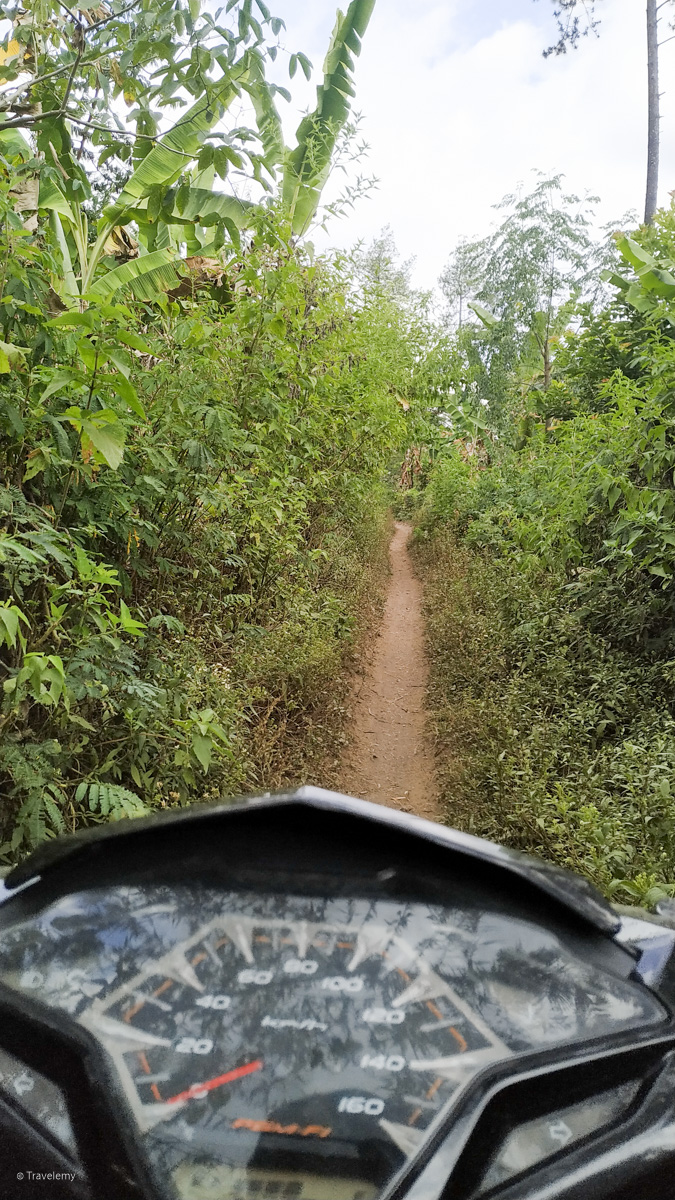
Last few kilometers of the road was in quite bad condition, with countless bumps and close calls of the bike falling down. Once you reach the end of the road, you will see the trail straight ahead and going up. You can ride a motorbike/scooter up this way, and it can save quite a lot of time and effort.
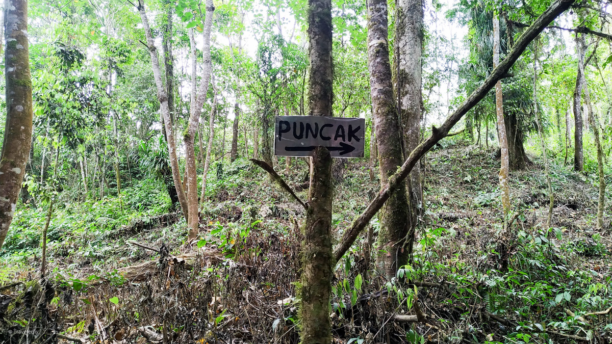
This small trail leads through coffee plantations. It's quite easy to follow the road, but you will see small hand-written signs on trees showing the trail.
On the way to the crater
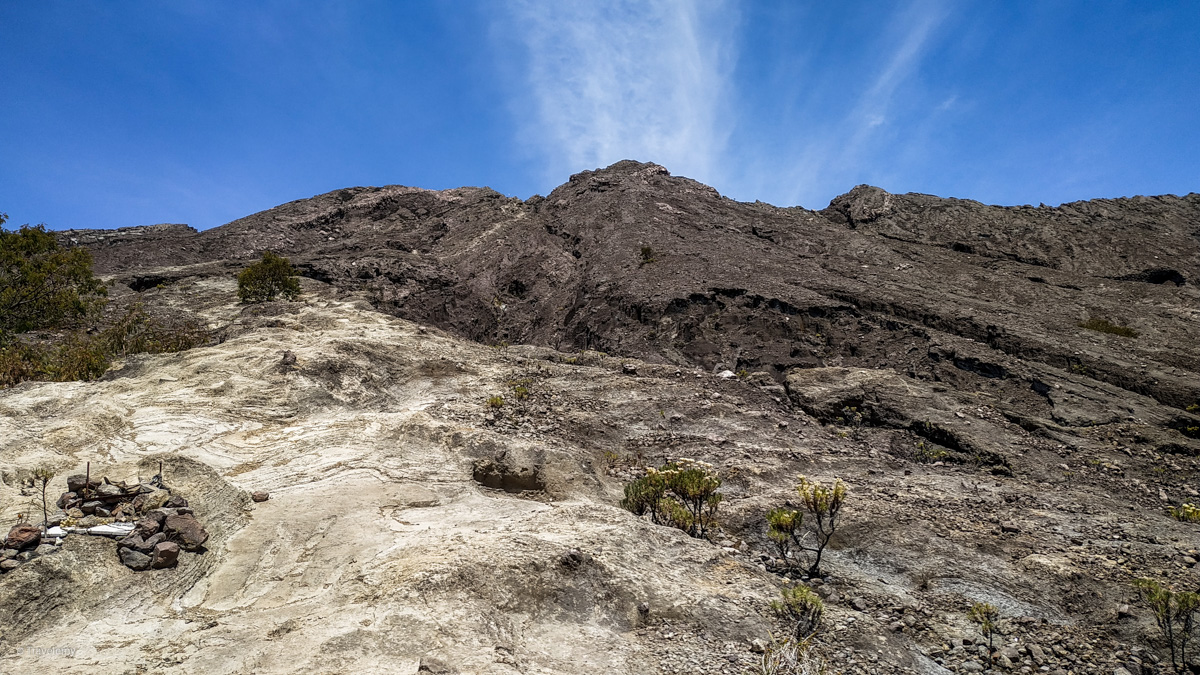
The hike itself wasn't something to write home about. The road whole trail was surprisingly well way-marked. There are no huts or proper resting places (unlike Gunung Rinjani, for example), but you will see several water bottle wrappers tied to trees throughout the trail.
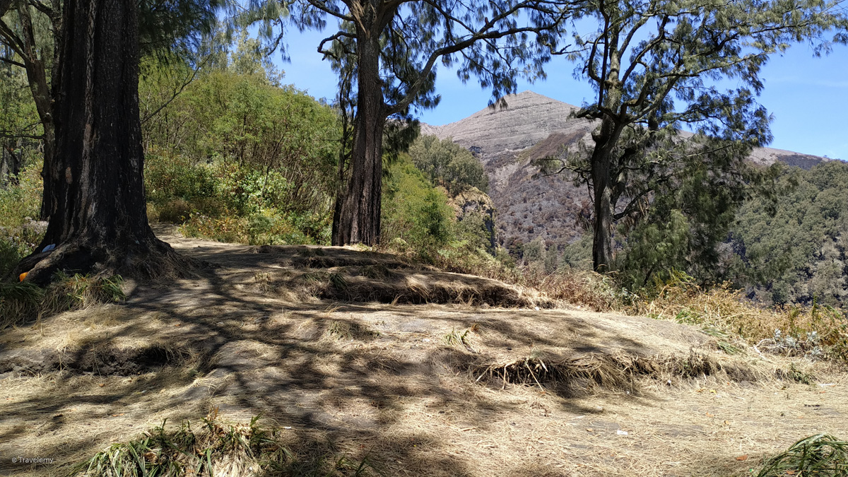
Despite the overgrown grass and fallen down trees, finding the way was the least of my worries; walking in the trail was! Those overgrown grass and bushes will bruise your limbs in a matter of minutes into the trail. The whole area is dry throughout the year, it wasn't as enjoyable as I expected first.
There are several resting spots in the trail. I have marked many of them Open Street Maps. There are two prominent spots. Most of the camping grounds are very small and are not nearly as comfortable as other camping grounds you have probably stayed in other Indonesian volcanoes.
- Camping ground at ~2,300m: This is probably the biggest spot of all. You can fit 5-10 tents here, and it is somewhat covered with pine trees. Plenty of space to cook some food as well, but beware of dry grass on the ground
- Camping ground at ~2,800m: This is the final spot and can be a good place for those sunrise views. This is smaller than the camping ground before, but has better views.
None of the camping grounds have water.
Because I took a late-start, I could not make it to any of the proper camping grounds. I stayed at ~1,800m, in a small spot that would fit only a couple tents. It was quite well covered to be warm at night, and compensated for my relatively light-weight sleeping gear.
About 10-20 minutes after the final camping ground, the treeline and vegetation ends. There is a small memorial for someone who passed away.
You will be looking at the final stretch of the hike to the crater, and this was my favorite part!
To The crater!
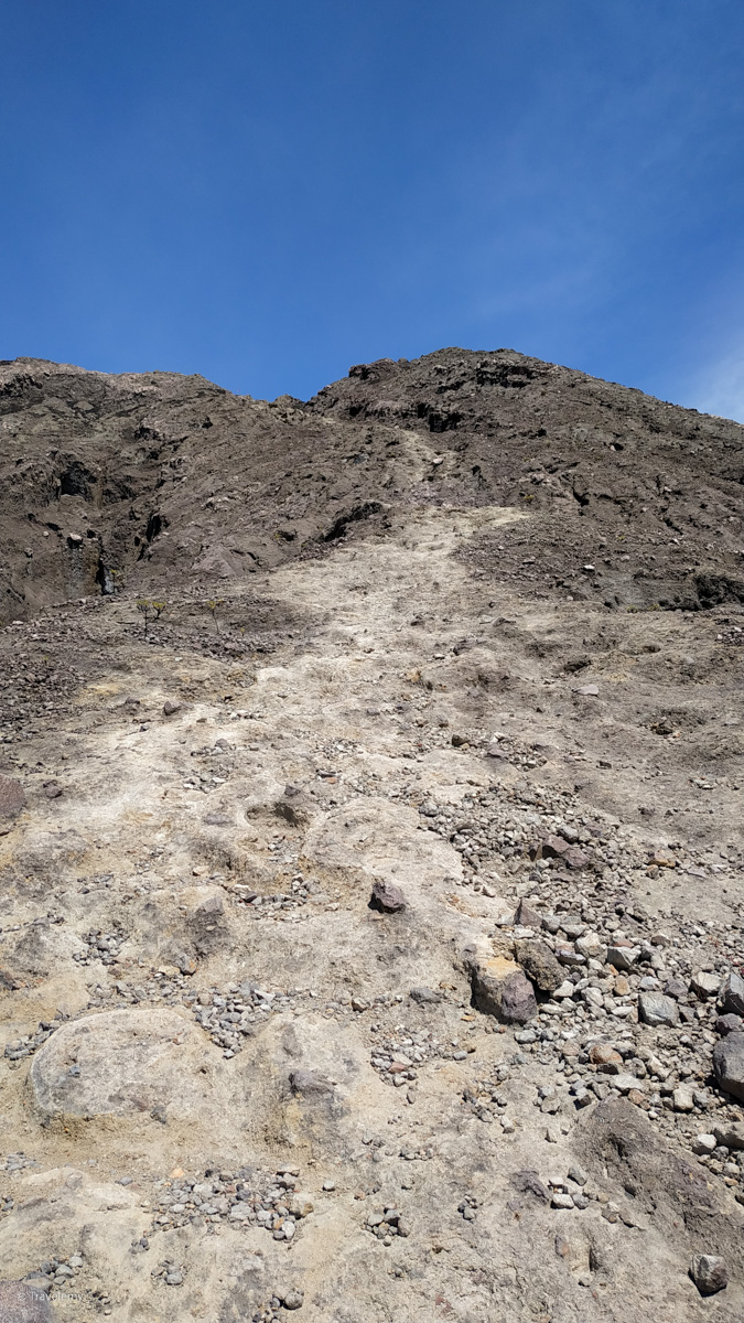
When you pass the last few hints of vegetation, you will be walking on solid volcanic rock. This was similar to the hike at Gunung Agung, minus you'd need to use your hands to climb up.
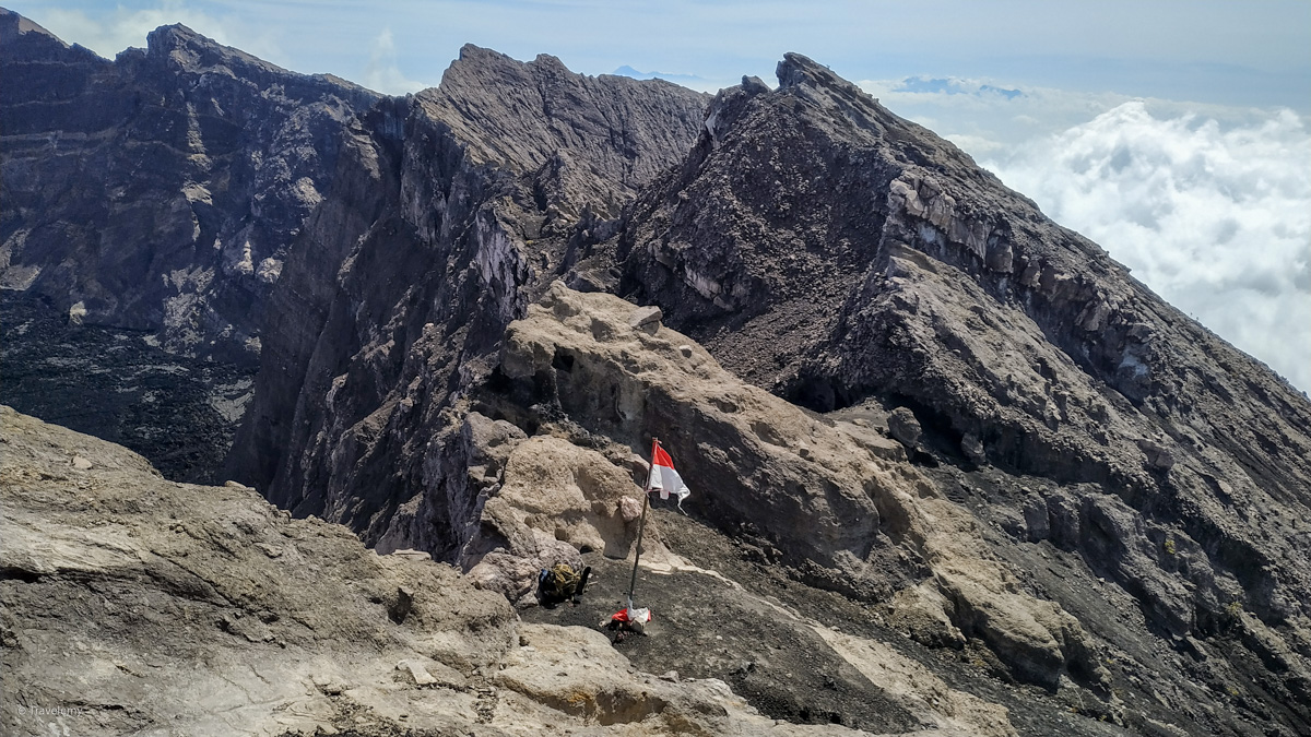
The rest of the hike was very enjoyable and easy. There was a lot of wind, and you will have a small ridge to walk, so be careful to not fall down! You will see an Indonesian flag, and just walk towards it! I was so pumped up with the adrenaline rush and practically ran the rest of the way to the crater.
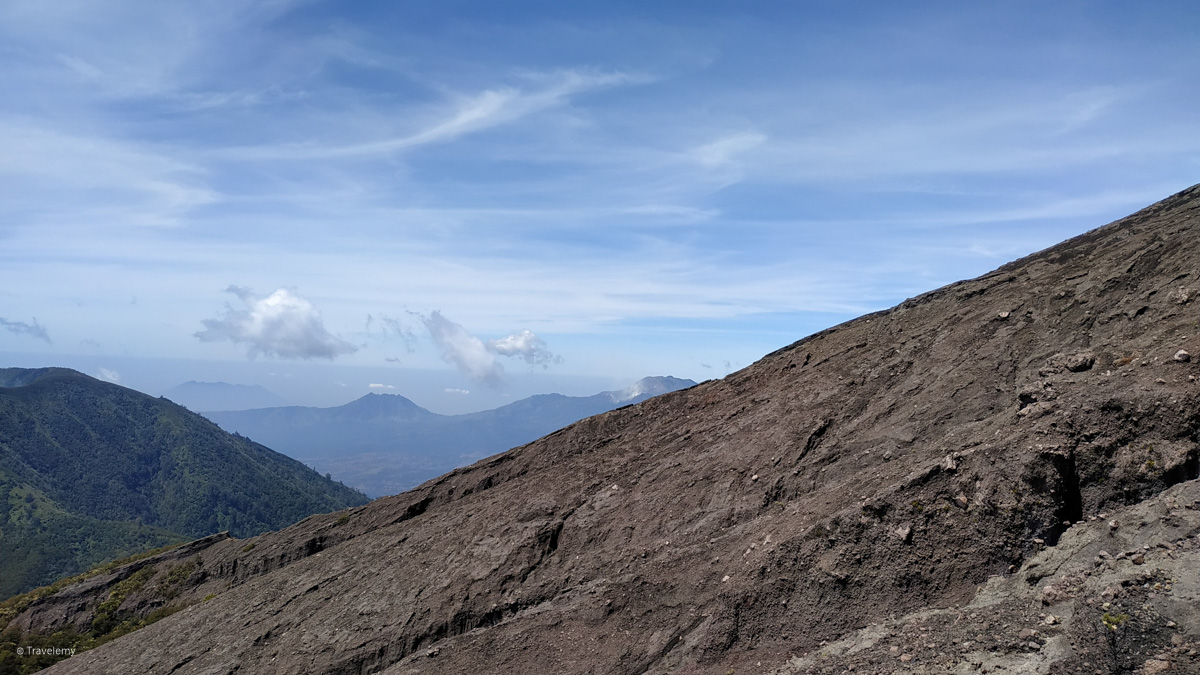
On a clear day, you can get a glimpse of Ijen crater to your left, and that was a magical sight indeed. You will be surrounded by several mountains in the area. It can get a bit cloudy later in the day, so a sunrise hike would be ideal.
The hike in the volcanic rock will take 30-45 minutes, and you will feel your excitement build up as you get closer to the crater. That Indonesian flag on the crater rim will work its magic helping you find your way and mental energy to push that last bit.
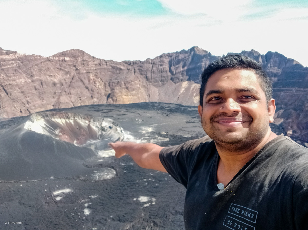
Walk the last few meters up, and the amazing views of Gunung Raung crater will be waiting for you to aw you!
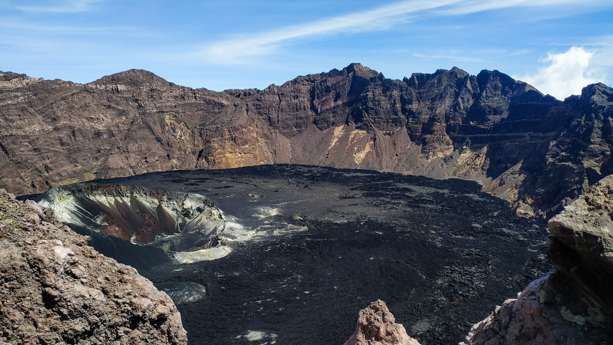
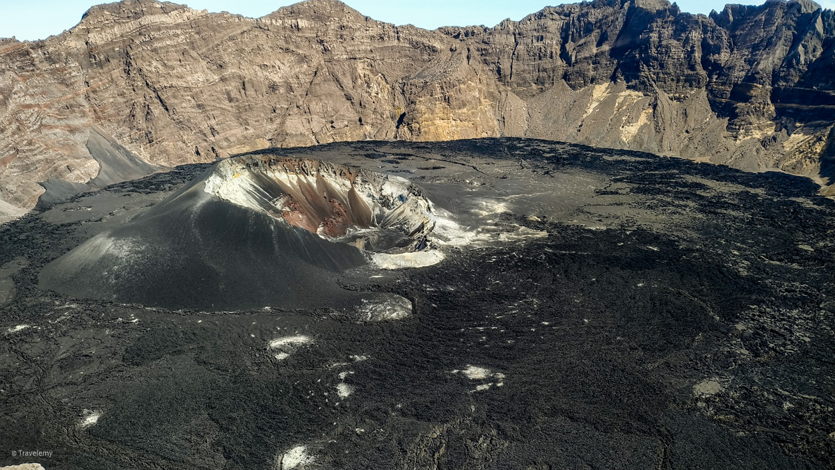
It can be quite windy up there, and be careful when you walk along the crater. There is a small yet obvious way to go a little bit higher, but the danger lies both sides of you: You could either fall down the vertical crater walls, or roll down the other-side; none of the outcomes in your favor. To your left will be the second highest peak of the mountain, and straight ahead and a bit right will be the absolute peak. There is no way to access other peaks from where you will be, even with rock climbing gears, so play it safe - you made it to the crater after all!
The small path to the left will give you better views all around. Ijen crater is covered from the Raung crater rim, but you can get a good view of Raung crater.
To the farther left region, there is a small dome that you can see a small stream of smoke coming out constantly. The entirety of the crater is full of black volcanic sand, giving it a mysterious look making your 6-7 hour hike up there worth it!
On the way back
After the amazing views at the crater, I started the descend back to my motorbike. The volcanic rock part was a bit difficult when going down, often making me use all fours to climb back. I left my big back pack at final camping grounds, and I suggest you do the same because the descend could get tricky with a big bag on your back.
You can pretty much run the rest of the way. It took me about 5 hours to reach my motorbike. You will be taking the same way up.
Be careful that the road is a bit difficult to follow back at the coffee plantations at night. Ride/walk slowly and check with a map every few minutes. A small head lamp wouldn't be enough to cut through the darkness, and having my motorbike certainly helped.
Sumberwringin is a small village, and by the time I was back there, I couldn't find any open restaurants for my daily Nasi Pecel craving. The next village had an Indomaret (The 7-Eleven equivalent in Indonesia) that is open 24 hours, a gas station, and a bunch of restaurants.
I went on my motorbike all the way back to Banyuwangi on the same night via the same way you would take for Ijen. Bondowoso is the nearest city that you would find some accommodation for large groups. There is an office at Sumberwringin, that looked like was there for the authorities for the volcano. They will surely help you out if you face any troubles.